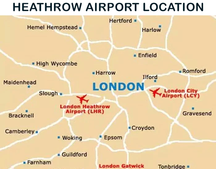
Heathrow Airport Location and Directions
Heathrow Airport (LHR) is the largest and busiest airport in the UK, located 14 miles (23 km) west of Central London. As a major international hub, Heathrow serves over 100 destinations worldwide, offering seamless connectivity to passengers from across the globe.
Heathrow Airport Address
Address: Hounslow, TW6 1QG, UK
Coordinates: Latitude: 51.470020, Longitude: -0.454295
Heathrow Airport lies on the western edge of London, designated as part of the Metropolitan Green Belt. It’s located approximately:
- 16 miles from Camberley
- 24 miles from Reading
- 3 miles south of Hayes
- 3 miles west of Hounslow
- 3 miles northeast of Staines-upon-Thames

Travel Times to Heathrow from London
Depending on your mode of transport, the time to reach Heathrow Airport from Central London varies:
- By Train: 15 minutes via Heathrow Express
- By Taxi: 30 minutes (Fare: £45–£70)
- By London Underground: 45 minutes
- By Bus: 50 minutes
Taxis are available at each terminal, offering direct transfers to Central London and other nearby destinations.
Where is Heathrow Airport on the Map?
Use the interactive Google Map below to explore the location of Heathrow Airport (LHR) and find directions to and from the airport.